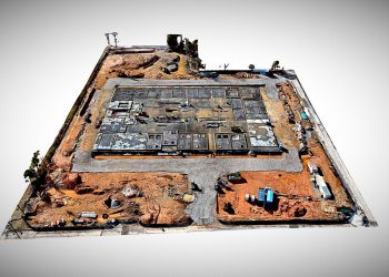
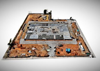
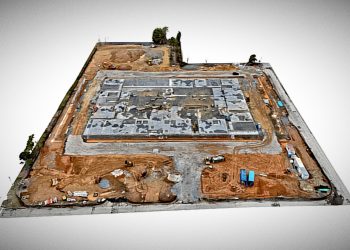
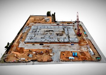
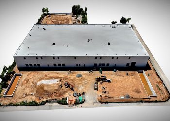
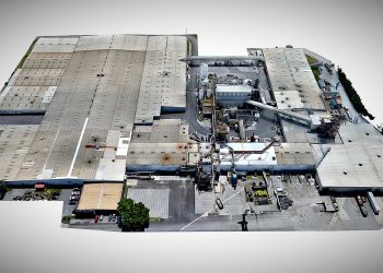
Lakeforest Mall Redevelopment
Weekly Progress Monitoring
Created by DRONE FIDELITY® | www.dronefidelity.com | Advanced Aerial Imaging Solutions® | 415-999-9994
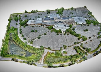
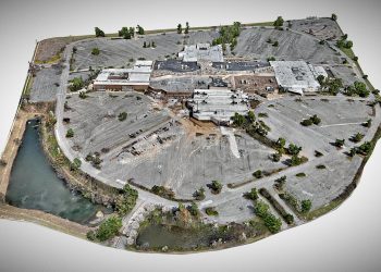
This project highlights ongoing site transformation at the 100-acres Lakeforest Mall Redevelopment site in Gaithersburg, Maryland. Weekly aerial capture & 3D models provide a consistent, high-resolution record of demolition, site preparation, and construction progress. High-resolution 3D photogrammetry models document construction progress from start to finish. Generated using advanced aerial imaging platforms and processed into a textured mesh, 3D models provide an interactive record of site conditions.
Drone-based reality capture enables developers, builders, and stakeholders to remotely review grading, infrastructure installation, and site activity with greater clarity and frequency than traditional methods. Weekly models help maintain visibility, improve coordination, and create a consistent visual record from groundbreaking through completion.
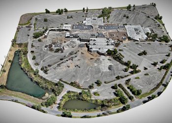
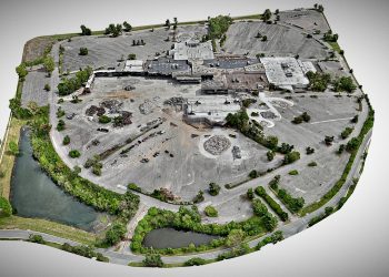
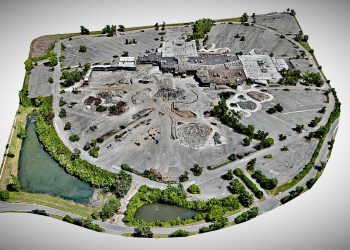
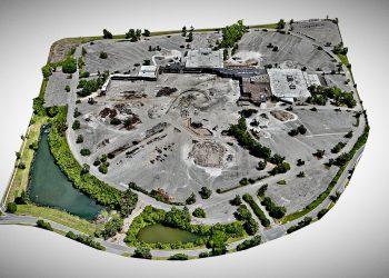
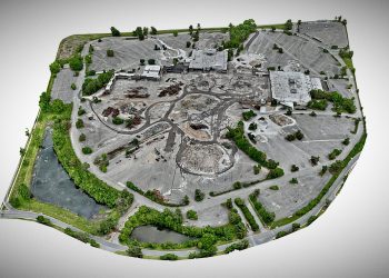
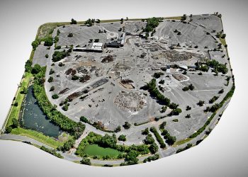
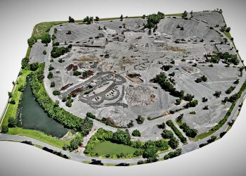
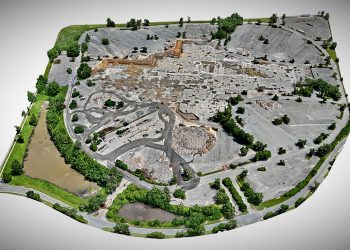
Documenting Transformation at Scale
Large-scale redevelopment projects involve constant change across demolition activity, site preparation, infrastructure modification, and phased construction operations. Capturing these transitions through recurring aerial reality capture provides stakeholders with a clear visual timeline of site evolution while preserving an accurate historical record of redevelopment progress from week to week.
For the Lakeforest Mall redevelopment project, DRONE FIDELITY® utilizes repeatable drone-based photogrammetry workflows to create interactive 3D models and high-resolution aerial documentation that support stakeholder communication, project visibility, and long-term archival documentation throughout the redevelopment lifecycle. These models allow project teams to remotely review changing site conditions, monitor demolition and grading progress, and maintain broader situational awareness across this large and continually evolving property.
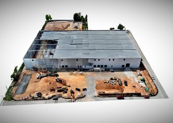
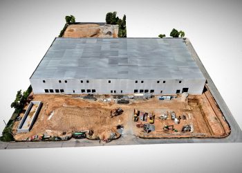
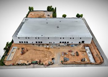
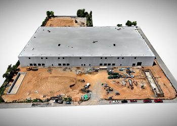
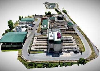
Construction Progress Monitoring
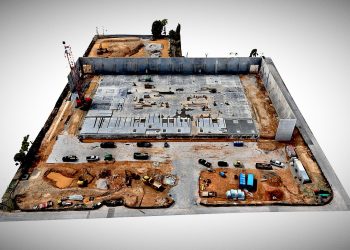
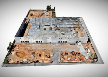
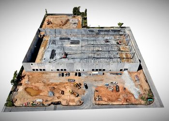
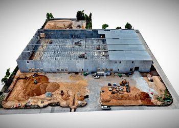
100,000 Square Foot Tilt-Up Commercial Warehouse
Created by DRONE FIDELITY® | www.dronefidelity.com | Advanced Aerial Imaging Solutions® | 415-999-9994
This interactive 3D photogrammetry model documents the ongoing construction of a 100,000 square foot tilt-up commercial warehouse facility located in Rockville, Maryland. Captured as part of a recurring weekly drone-based progress monitoring program, the site was reconstructed into a high-resolution textured mesh to support project visualization, documentation, and stakeholder coordination throughout the construction lifecycle.
Weekly aerial modeling provides owners, developers, construction managers, and project stakeholders with improved visibility into structural progress, site logistics, panel installation, grading activity, and overall jobsite conditions. Drone-based reality capture creates a consistent historical record of construction progress while supporting remote review, project communication, and long-term documentation.

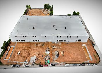
A Consistent Visual Record of Project Progress
Construction sites evolve rapidly, making consistent documentation increasingly valuable as projects advance through grading, structural work, utility installation, and final build-out phases. Recurring aerial capture provides owners, developers, contractors, and stakeholders with a reliable way to review visible site activity, monitor progression over time, and maintain alignment across teams without requiring constant on-site presence.
Using repeatable drone-based reality capture workflows, DRONE FIDELITY® creates high-resolution 3D models and aerial documentation that support project communication, progress verification, stakeholder reporting, and historical project records throughout the construction lifecycle. Interactive models provide a broader site perspective than traditional progress photos alone, helping teams better visualize logistics, sequencing, staging activity, and overall site development from week to week.
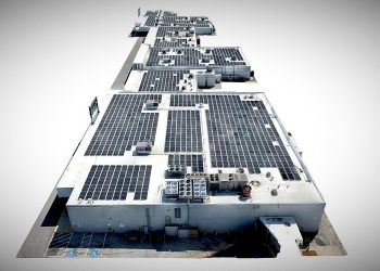
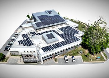
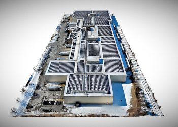
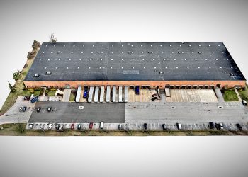
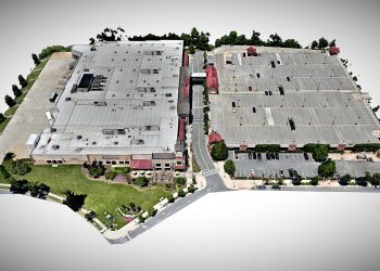
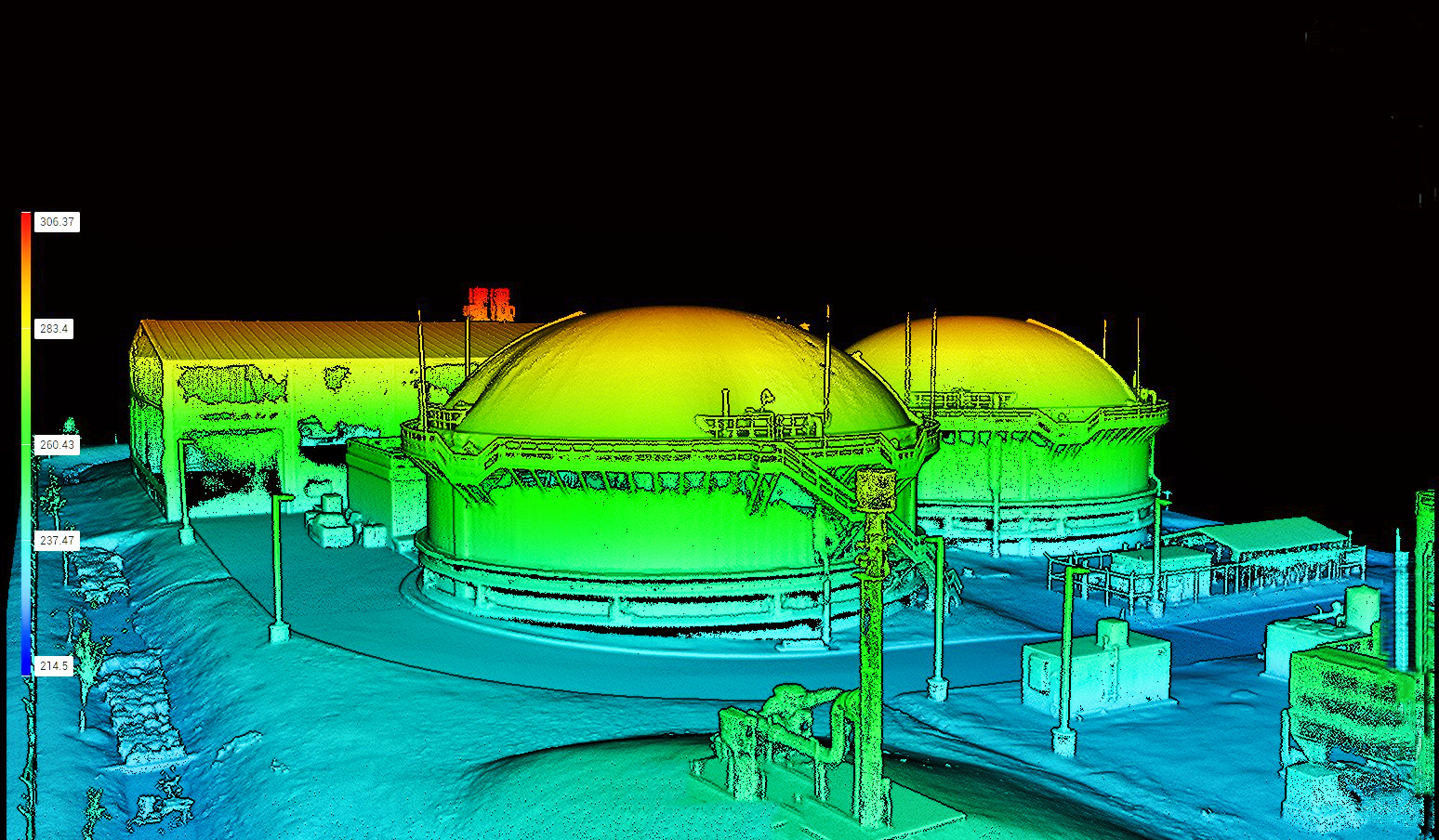
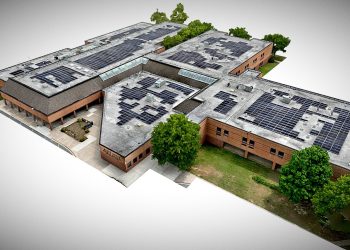
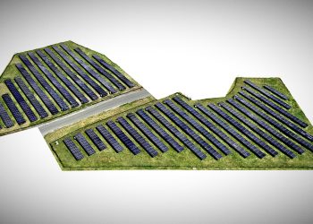
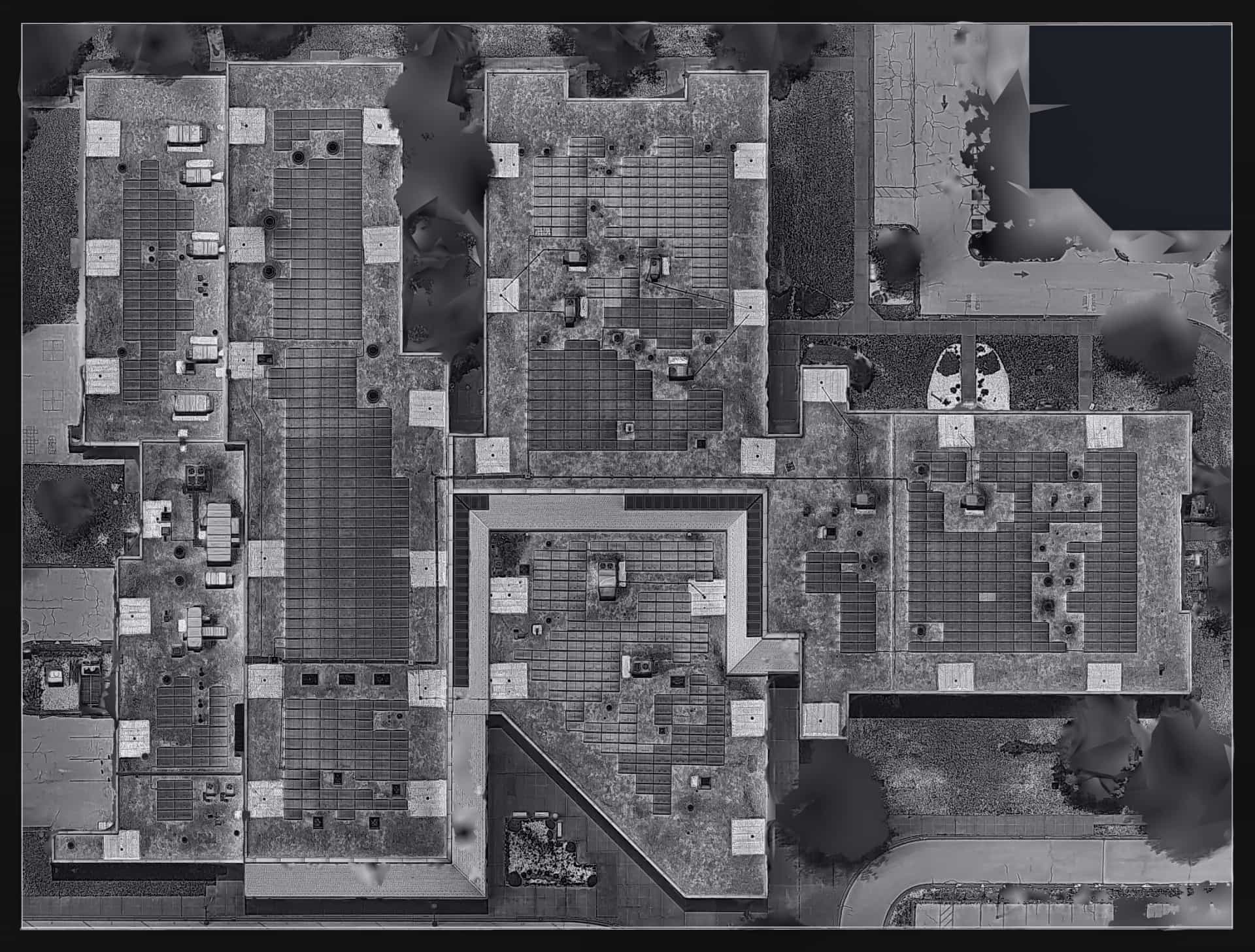
Infrastructure & Asset Inspections
Commercial & Industrial Asset Visualization
Created by DRONE FIDELITY® | www.dronefidelity.com | Advanced Aerial Imaging Solutions® | 415-999-9994
This collection of interactive 3D photogrammetry models showcases drone-based infrastructure and asset inspection projects captured across a variety of commercial, industrial, and utility-related environments throughout the Mid-Atlantic region. Using advanced aerial reality capture workflows, each site was reconstructed into a high-resolution textured mesh to support inspection, visualization, documentation, and long-term asset management.
Projects featured include commercial rooftop solar installations, industrial renewable energy infrastructure, freight and logistics facilities, civic infrastructure, parking structures, and large-scale commercial properties. Drone-based inspection modeling provides stakeholders with improved visibility into site conditions, rooftop assets, structural layouts, and installation progress while reducing the need for manual rooftop access and improving overall inspection efficiency and safety.
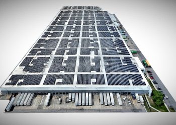
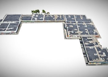
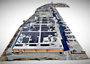
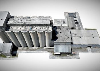
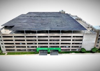
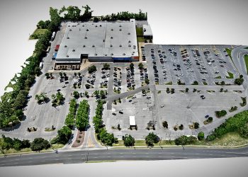
Safer Access. Clearer Visibility. Better Documentation.
Modern drone-based inspection workflows provide a practical way to evaluate commercial and industrial assets that are difficult, costly, or hazardous to access using traditional methods. High-resolution aerial modeling allows stakeholders to remotely review rooftop systems, structural layouts, equipment placement, and surrounding site conditions from a comprehensive visual perspective.
By integrating photogrammetry, thermal imaging, and repeatable aerial capture techniques, DRONE FIDELITY® helps clients create detailed visual records that support inspection planning, infrastructure assessment, maintenance coordination, and long-term asset documentation. These interactive models improve visibility across teams while helping reduce unnecessary rooftop exposure, lift usage, and operational disruption during inspection activities.
Photogrammetry & 3D Modeling
Survey-Grade Mapping & Reality Capture Models
Created by DRONE FIDELITY® | www.dronefidelity.com | Advanced Aerial Imaging Solutions® | 415-999-9994
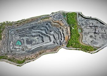
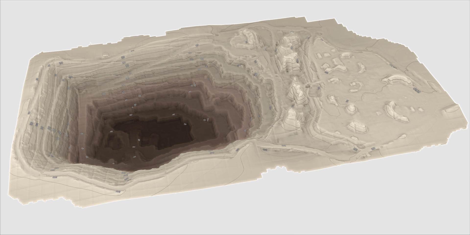
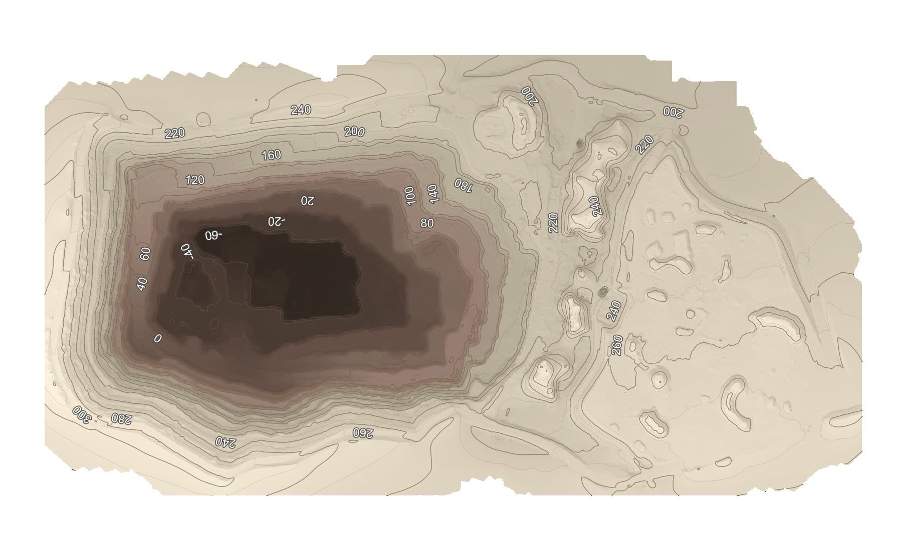
This collection of interactive photogrammetry and 3D modeling projects showcases high-accuracy aerial mapping and reality capture workflows performed using advanced drone-based imaging and geospatial processing techniques. Captured primarily using the DJI Matrice 4E and processed through professional photogrammetry workflows, each project was reconstructed into detailed textured mesh models and geospatial deliverables to support visualization, planning, analysis, and long-term documentation.
Projects featured include large-scale quarry mapping, terrain visualization, elevation and contour analysis, civic infrastructure modeling, and commercial site reconstruction. Drone-based photogrammetry provides stakeholders with accurate spatial context and highly detailed visual representations of real-world environments while supporting engineering review, project planning, progress documentation, volumetric analysis, and infrastructure assessment workflows.
Turning Real-World Environments Into Actionable Spatial Data
Modern photogrammetry workflows allow complex environments to be reconstructed into detailed digital models that provide far more context than traditional aerial imagery alone. By combining high-resolution drone capture with advanced geospatial processing techniques, DRONE FIDELITY® creates interactive 3D models and mapping deliverables that help stakeholders better understand terrain, structures, elevation changes, site layout, and surrounding environmental conditions.
These models support a wide range of planning, engineering, visualization, and documentation workflows across construction, infrastructure, land development, and industrial environments. From large-scale terrain reconstruction and quarry mapping to orthomosaic generation, contour analysis, and textured mesh modeling, drone-based reality capture provides accurate spatial context while creating a permanent digital record of existing site conditions.
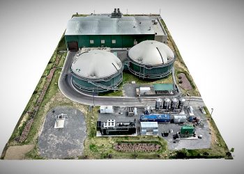
Thermal & Specialty Imaging
Advanced Thermal Inspection & Visual Analysis
Created by DRONE FIDELITY® | www.dronefidelity.com | Advanced Aerial Imaging Solutions® | 415-999-9994
This collection highlights drone-based thermal imaging and specialty aerial inspection projects performed using advanced multisensor capture workflows throughout the Mid-Atlantic region. Utilizing the DJI Matrice M400 & 4T platforms, Drone Fidelity® combines thermal data, high-resolution RGB imagery, and aerial reality capture techniques to support inspection, assessment, visualization, and documentation across commercial, industrial, and infrastructure environments.
Projects featured include rooftop solar inspections, commercial roofing assessments, infrastructure evaluation, utility-related imaging, and thermal anomaly identification. Thermal aerial imaging provides stakeholders with additional insight into conditions that may not be visible through standard RGB imagery alone, helping support inspection planning, maintenance evaluation, and more informed decision-making while improving safety and reducing unnecessary manual access requirements.
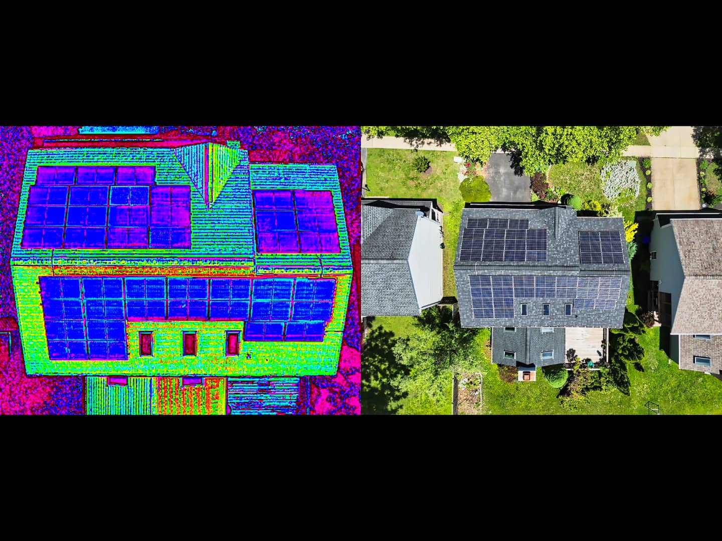
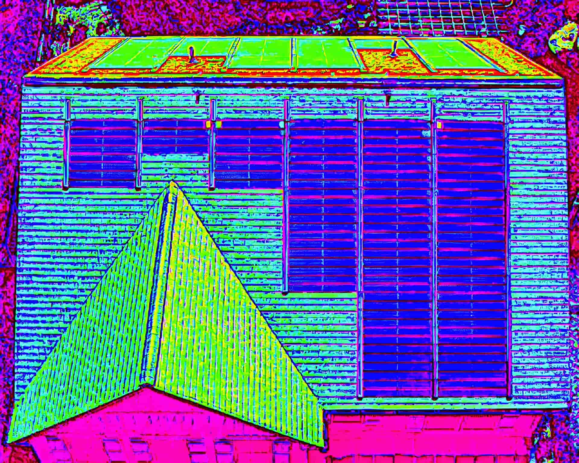
Additional Insight Beyond Standard Visual Imaging
Thermal imaging can reveal temperature variations and conditions that are often difficult or impossible to identify through conventional aerial photography alone. When combined with high-resolution RGB imagery and spatial context from drone-based reality capture, thermal data provides stakeholders with a more comprehensive understanding of asset conditions, rooftop systems, infrastructure components, and site-specific areas requiring additional review.
DRONE FIDELITY® utilizes advanced thermal imaging workflows to support commercial and industrial inspection scenarios where enhanced visual analysis may improve efficiency, reduce manual access requirements, and assist with documentation and assessment activities. By integrating thermal capture with repeatable flight operations and detailed aerial modeling, clients receive clearer visual context and more informative inspection deliverables tailored to their project needs.